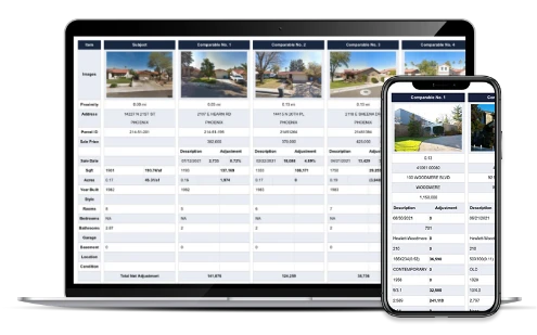
ATTOM’s Property Reports include the ability to find and filter comps—including private sales— based on location, date, price, and and a range of property attributes.
Sign Up NowProperty Report for 11090 State Route 85, Kittanning, PA 16201
Find Comparables
- Property Address 11090 State Route 85, Kittanning, PA 16201
- County Armstrong
- Parcel ID 46-0-031950
- Legal description MAP NO:133.00-06-01; 5.36A-IMPRS. ACT 319 - MIXED USE
- School district Armstrong School District
- Acreage 5.36
- Property class Single Family Residence
- Zoning Subscribe
- Square footage 2,016
- Year built 1963
- Bedrooms 4
- Bathrooms 2
About the Property
11090 State Route 85 is a single family residence in the city of Kittanning, PA 16201. Located in the Armstrong School District, which resides in Armstrong County, PA and built in 1963. This Single Family Residence sits on a 233,482 sq ft lot and features 4 bedrooms, 2 bathrooms and 2,016 sq ft of living space.
The most recent property tax for 11090 State Route 85 was $3,774 with an estimated market value range of $196,881 to $217,606. This property was last sold on October 23, 2008.
Property Info
Sign up to see full Property Info for 11090 State Route 85, Kittanning
- MAP NO:133.00-06-01; 5.36A-IMPRS. ACT 319 - MIXED USE
- Classification SINGLE FAMILY RESIDENCE
- County ARMSTRONG
- FIPS 42005
- Civil Division VALLEY
- Census 420059506.002021
- Parcel ID 46-0-031950
- Neighborhood N/A
- Tract 0
- Secondary School District N/A
- Primary School District Armstrong School District
- Acres 5.36
- Square Feet 233,482
- Units N/A
- Year Built 1963
- Effective Year Built N/A
- Stories 1
- # Fireplaces N/A
- Garage/Carport 672 sq.ft.
- Cooling Central
- Heating Forced Air
- Square Footage
- Living Area 2,016
- Total Rooms 6
- Bedrooms 4
- Total Bathrooms 2
- Full Bathrooms 1
Kittanning Residential Market Stats
See more Real Estate Trends for Kittanning including home values, types of properties sold and transaction volumes.
Taxes and Assessments for 11090 State Route 85, Kittanning
| Tax Year | Taxes | Tax Assesed Value | Exemptions |
|---|---|---|---|
| 2025 | $3,774 (+5.9%) | $41,960 | |
| 2024 | $3,565 | $41,960 | |
| 2023 | $3,565 | $41,960 | |
| 2022 | |||
| 2021 | |||
| 2020 | |||
| 2019 |
Sales History for 11090 State Route 85, Kittanning
| Sale Date | Recorded Date | Buyer(s) | Seller(s) | Price | Document ID |
|---|---|---|---|---|---|
| Address | Distance | SqFt | Sale Date | Price | $/SqFt |
|---|---|---|---|---|---|
| 10240 STATE ROUTE 85 | 4.02 mi | 1,674 | 07/01/2025 | $20,000 | $12 |
| 160 CORNMAN RD | 3.76 mi | 1,755 | 06/10/2025 | $389,000 | $222 |
| 290 ADAMS RD | 1.17 mi | 2,154 | 05/28/2025 | $160,040 | $74 |
Sign up to access
- 1. Kittanning
- 2. Manorville
- 3. Mc Grann
- 4. Rural Valley
- 5. Ford Cliff
- 6. Nu Mine
Various data sets have been provided by a third party or government source and are subject to change and possible errors. Depending on location and source, data may be missing or not available. Information is deemed reliable but not guaranteed to be accurate, up-to-date, or complete. Buyers, investors, and others are responsible for verifying the accuracy of all information.

