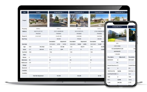
ATTOM’s Property Reports include the ability to find and filter comps—including private sales— based on location, date, price, and and a range of property attributes.
Sign Up NowProperty Report for 20 1/2 Main St E, Wartrace, TN 37183
Find Comparables
- Property Address 20 1/2 Main St E, Wartrace, TN 37183
- County Bedford
- Parcel ID 071E D 00701
- Legal description DISTRICT: 03, COUNTY AREA: N01
- School district Bedford County School District
- Acreage 0.08
- Property class Retail
- Zoning Subscribe
- Square footage 2,366
- Year built 1900
- Bedrooms
- Bathrooms 0.5
About the Property
20 1/2 Main St E is a retail in the city of Wartrace, TN 37183. Located in the Bedford County School District, which resides in Bedford County, TN and built in 1900. This Retail sits on a 3,328 sq ft lot and features 1 bathrooms and 2,366 sq ft of living space.
This property was last sold on June 05, 2025 for $220,000.
Property Info
Sign up to see full Property Info for 20 1/2 Main St E, Wartrace
- DISTRICT: 03, COUNTY AREA: N01
- Classification RETAIL STORES (PERSONAL SERVICES, PHOTOGRAPHY, TRAVEL)
- County BEDFORD
- FIPS 47003
- Civil Division 1
- Census 470039507.001030
- Parcel ID 071E D 00701
- Neighborhood N/A
- Tract 0
- Secondary School District N/A
- Primary School District Bedford County School District
- Acres 0.08
- Square Feet 3,328
- Units 1
- Year Built 1900
- Effective Year Built 1971
- Stories 1
- # Fireplaces N/A
- Garage/Carport N/A
- Cooling Yes
- Heating Yes
- Square Footage
- Living Area 2,366
- Total Rooms N/A
- Bedrooms N/A
- Total Bathrooms 0.5
- Full Bathrooms 0.5
Wartrace Residential Market Stats
See more Real Estate Trends for Wartrace including home values, types of properties sold and transaction volumes.
Taxes and Assessments for 20 1/2 Main St E, Wartrace
| Tax Year | Taxes | Tax Assesed Value | Exemptions |
|---|---|---|---|
| 2024 | $22,680 | ||
| 2022 | $772 (+19.3%) | $22,680 | |
| 2021 | $647 | $22,680 | |
| 2020 | |||
| 2019 | |||
| 2018 | |||
| 2017 |
Sales History for 20 1/2 Main St E, Wartrace
| Sale Date | Recorded Date | Buyer(s) | Seller(s) | Price | Document ID |
|---|---|---|---|---|---|
| Address | Distance | SqFt | Sale Date | Price | $/SqFt |
|---|---|---|---|---|---|
| 253 ADAMS LN | 4.57 mi | 2,666 | 06/06/2025 | $730,000 | $274 |
| 232 UNION RIDGE RD | 3.63 mi | 2,088 | 03/14/2025 | $165,000 | $79 |
| 205 NORMANDY RD | 4.98 mi | 2,743 | 10/08/2024 | $635,000 | $231 |
Sign up to access
- 1. Wartrace
- 2. Normandy
- 3. Bell Buckle
- 4. Shelbyville
- 5. Christiana
- 6. Beechgrove
Various data sets have been provided by a third party or government source and are subject to change and possible errors. Depending on location and source, data may be missing or not available. Information is deemed reliable but not guaranteed to be accurate, up-to-date, or complete. Buyers, investors, and others are responsible for verifying the accuracy of all information.

